A new alliance between three companies specialising in different aspects of 3D modelling promises to up the ante in the constantly evolving world of digital image modelling in Australia.
Three companies have joined forces in South Australia to develop a capability to create three-dimensional visuals – from the panoramic to the highly detailed – of virtually any proposed building or development project.
The joint venture between Redstack, Maptek and Avitus UAV Systems was inspired by the standard of end-to-end reality capture commonly available to businesses in Europe and the United States, but the game changer could turn out to be closer at hand – the redevelopment of Adelaide Oval in South Australia.
Redstack managing director Michael Lachs says the regular flow of sophisticated visuals that showed the public how the new stadium would look and how it would fit in with its surroundings raised the bar in terms of what can be achieved and what should be expected.
Redstack, which specialises in CAD equipment, services and training to architecture and engineering firms in Australia, saw the potential to offer this level of expertise and technology across a range of industries in Australia.
“We have seen the progression of digital technology through all the aspects of manufacturing and building,” Lachs said. “For us the next natural progression was the digitisation of existing pre-made objects. How do we get something existing into a digital form so that we can utilise it within our design process?”
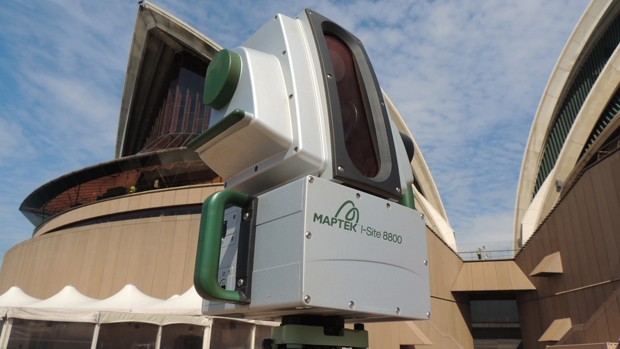
The answer was to approach Maptek, a specialist in 3D laser scanning software whose past projects include the Sydney Opera House and whose products are used at 1,700 mining sites in 65 countries.
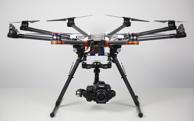
And to get all this digital scanning and storage power off the ground they approached Avitus to build and pilot the venture’s specially-built Pegasus hexicopter drone.
The result is a capability to create striking and very accurate 3D models of projects, whether planned or already in progress, which incorporate existing features and proposed additions and take account of the natural elements.
They can show how a new building will fit in – and impact on – an existing cityscape, or provide a clear idea of how a redeveloped interior would look. The images can be shown on screen or converted into scaled models.

“In Australia there are people doing the video capture, people strapping scanners onto UAVs and offering a scanning service, but I haven’t come across anyone who is offering such a complete and integrated reality capture and modelling capability,” Lachs said.
“We built our own UAV to ensure we had just what we needed for a variety of uses and we are already looking to make further improvements, such as adding infra-red capability and extra safety features to meet industry expectations.”
With his eye to the future, Lachs can still remember the “old school” approach. It’s only 15 years ago that he was asked to create a model of how new light towers might look on Adelaide’s King William Street bridge.
That meant walking down there with a tape measure then going back to his computer and inputting each of the components to create the model.
Nick Carne is a writer for The Lead South Australia.
